El mapa de los espacios de datos para la sostenibilidad medioambiental
Tabla de Contenidos
El valor de los espacios de datos para la sostenibilidad
En Libelium trabajamos activamente en estos frentes, asegurándonos de que cada paso adelante fortalezca nuestra misión de conectar, impulsar y transformar las ciudades y comunidades del mañana.
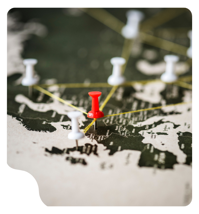
Los espacios de datos son una herramienta clave para planificar mejor los territorios, adaptarse al cambio climático, optimizar movilidad, gestionar el turismoy proteger infraestructuras críticas.
La IA, democratización y federación están transformando Europa
El futuro de los espacios de datos se construye sobre tres grandes ejes:
Inteligencia artificial al servicio del dato
Herramientas No-Code y Low-Code
Federación europea de espacios de datos
Para automatizar procesos, generar insights predictivos y optimizar recursos en tiempo real.
Que democratizan el acceso a la tecnología y permiten que personal técnico no especializado pueda configurar flujos de datos y reglas de gobernanza de forma sencilla y visual.
A través de iniciativas como DOME Marketplace o Citcom.AI, que fomentan un mercado común de soluciones cloud, edge e IA validadas por la Unión Europea.
Libelium y su papel en los espacios de datos
En Libelium no sólo proporcionamos tecnología IoT o plataformas de datos, co-creamos ecosistemas digitales que permiten a las ciudades pasar de los datos brutos a la toma de decisiones inteligentes.
Lideramos la línea de negocio de espacios de datos y gemelos digitales, actuando como integrador y socio estratégico de administraciones públicas, centros de investigación y empresas.
Nuestra visión es clara: un espacio de datos no es solo una arquitectura técnica, sino una infraestructura compartida para generar valor colectivo, donde interoperabilidad, gobernanza y sostenibilidad son tan importantes como los sensores o los algoritmos.
Casos de uso reales de espacios de datos
DEPLOYTOUR – Turismo inteligente y sostenible
¿Qué hace? Desarrolla el Espacio de Datos Turísticos Europeo (ETDS) para fortalecer la competitividad, sostenibilidad y resiliencia del turismo en la UE.
Objetivo: Mejorar el acceso a datos fragmentados del turismo, apoyar la transición digital y ecológica de las pymes y destinos turísticos, y promover prácticas innovadoras.
Ubicaciones: Pilotos en Andalucía y Canarias (España), París (Francia), isla de Syros (Grecia), Laponia (Finlandia) y regiones alpinas (Eslovenia y Austria).
¿Cómo lo hacemos? A través del desarrollo de espacios de datos interoperables que recopilan y comparten información turística clave, integrando iniciativas como DATES, Gaia-X y SIMPL.
Shared data: Comportamiento y preferencias de los visitantes, transporte, alojamiento, eventos, infraestructura, impacto ambiental, patrimonio cultural y más.
Casos de uso: Apoyo a la toma de decisiones para gestores turísticos (públicos y privados), centrado en sostenibilidad, resiliencia, competitividad, patrimonio cultural e industria MICE.
SENSE - Virtualización urbana y participación ciudadana
¿Qué hace? Fortalece el sentido de pertenencia urbano mediante entornos virtuales que replican ciudades reales dentro de la iniciativa europea de Ciudades Inteligentes.
Objetivo: Enriquecer la vida urbana conectando ciudadanos y autoridades a través de experiencias inmersivas en 3D, integrando dimensión social, arquitectónica y ambiental.
Ubicaciones: Cartagena (Spain) and Kiel (Germany).
¿Cómo lo hacemos? Mediante la creación de entornos digitales interconectados que utilizan Realidad Virtual, metaverso y estándares de interoperabilidad europeos.
Shared data: 3D models, IoT data, urban planning, public transport, infrastructure, and other urban datasets.
Casos de uso: Urban virtualization to enhance citizen engagement, urban planning, infrastructure resilience, environmental awareness, and mobility.
Geo4Water - Resiliencia ante eventos hídricos extremos
¿Qué hace? Promovido por la European Data Space for Smart Communities (DS4SSCC-DEP), este espacio de datos se enfoca en urban resilience to extreme water events (floods, heavy rainfall) driven by climate change.
Objetivo: Mejorar la gestión urbana del agua y la respuesta ante desastres mediante integración de datos geoespaciales, ambientales e infraestructurales.
Ubicaciones: Valencia y San Javier (España), Oslo (Noruega) y Donegal (Irlanda).
¿Cómo lo hacemos? Creando un espacio de datos que fusiona imágenes satelitales, sensores IoT, meteorología y grabaciones aéreas.
Shared data: Mapas de inundaciones, contaminación del agua, daños a infraestructuras, resiliencia urbana e historial de eventos.
Casos de uso: Apoyo a decisiones en planificación urbana, monitoreo de infraestructuras y evaluación de daños, permitiendo desarrollar gemelos digitales para la resiliencia futura.
LDT-DS (Local Digital Twins Dataspace)
¿Qué hace? Crea una infraestructura común para compartir datos locales de alta calidad y desarrollar gemelos digitales interoperables.
Objetivo: Permitir el uso colaborativo de datos para abordar desafíos como el cambio climático, la economía circular o la contaminación cero, respetando la soberanía de los datos.
Ubicaciones: Granada, Las Rozas, Cartagena, Málaga y Valencia (España).
¿Cómo lo hacemos? Desarrollando espacios de datos FAIR (Findable, Accesible, Interoperable, Reusable) que conectan datos, algoritmos y aplicaciones de múltiples sectores.
Shared data: Consumo de agua y energía, transporte, residuos, estacionamiento, datos de sensores IoT, entre otros.
Casos de uso: Gestión ambiental y planificación urbana inteligente, movilidad sostenible, simulación de zonas de bajas emisiones y evaluación de impacto ambiental.
SC-DIXAE – Espacio de datos para la ciberseguridad urbana
¿Qué hace? Combina ciberseguridad, ciudades inteligentes y espacios de datos para prevenir y responder a amenazas digitales en entornos urbanos.
Objetivo: Su objetivo es mejorar la salud y la resiliencia urbana proporcionando soluciones basadas en datos para los gestores urbanos.
Ubicaciones: Piloto en Avilés (España).
¿Cómo lo hacemos? Mediante una infraestructura digital segura que garantiza la soberanía y el control sobre los datos de ciberseguridad urbana.
Shared data: Inventario de TI, accesos, vulnerabilidades, incidentes, redes IoT, tráfico, protocolos de seguridad, actualizaciones de software, entre otros.
Casos de uso: Evaluación de riesgos y vulnerabilidades, planificación de recuperación ante desastres digitales, gestión de incidentes y refuerzo de la seguridad en ciudades inteligentes.
BeatTheHeat - Soluciones contra las islas de calor urbanas:
¿Qué hace? Promovido por la European Data Space for Smart Communities (DS4SSCC-DEP), este espacio de datos se enfoca enddresses the urban heat island problem exacerbated by climate change by providing data-driven solutions to urban managers, improving city health and resilience.
Objetivo: Su objetivo es mejorar la salud y la resiliencia urbana proporcionando soluciones basadas en datos para los gestores urbanos.
Ubicaciones: Este proyecto colaborativo involucra a tres ciudades: Cartagena (España), Nápoles y Taranto (Italia), todas afectadas por el aumento de las temperaturas y las frecuentes olas de calor.
¿Cómo lo hacemos? El proyecto integrará diversas fuentes de datos como pronósticos meteorológicos, datos satelitales, sensores IoT y mapas urbanos en un ecosistema de datos compartido.
Shared data: El espacio de datos de BeatTheHeat creará conjuntos de datos de alto valor, incluyendo mapas de sombras, mapas de confort térmico, mapas de UHI y mapas de contaminación, para informar las decisiones sobre planificación urbana, movilidad y esfuerzos de mitigación del cambio climático.
Casos de uso: Los casos de uso son servicios de apoyo a la toma de decisiones para los gestores de la ciudad, proporcionando conjuntos de datos de alto valor como mapas de sombras, mapas de confort térmico, mapas de las islas de calor, mapas de contaminación y métricas de impacto en la salud. Esto permitirá a las ciudades mejorar la sostenibilidad y los resultados de salud, alineándose con los objetivos del Pacto Verde de la UE para la resiliencia urbana y la adaptación al cambio climático. Por ejemplo, los gestores podrán identificar las islas de calor, cuantificar la retención de calor y evaluar sus efectos en las temperaturas nocturnas.
El cambio no vendrá de hacer más de lo mismo
Vendrá de mirar donde otros no han mirado. De conectar piezas que parecían inconexas. De aprovechar los datos dormidos y transformarlos en experiencias, soluciones o decisiones mejores.
Los espacios de datos no son solo una política europea. Son el germen de nuevos modelos de negocio, aún por imaginar. Y si sabes leer entre líneas, el futuro está lleno de oportunidades sin reclamar.
Quizá la siguiente gran startup no se funde en un garaje, sino en un dataset compartido. Y quizá tú seas quien la ponga en marcha. And maybe you’ll be the one to launch it.
Behind the Change.
Beyond the Challenge.