
Smart Tourism & Crowd Monitoring: How La Unión Built its “Digital Brain”
Discover how La Unión (Murcia) uses Libelium’s IoT technology and iris360 to lead the way in...

Libelium combines environmental sensing, calibration expertise and advanced digital modelling to help cities and public authorities understand urban air-quality conditions, evaluate mobility and Low Emission Zone scenarios, and measure the impact of interventions over time.
Environmental monitoring tells you what is happening at a specific place and time. Effective air-quality management requires connecting those observations with their spatial context, mobility patterns, meteorology and future scenarios.
Libelium brings these layers together so organisations can move from detecting pollution to understanding its behaviour, evaluating interventions and verifying their real impact.
Monitor pollutant concentrations and environmental conditions across strategically distributed urban locations.
Combine field sensing, calibration expertise and environmental data-quality processes to create a stronger foundation for analysis.
Put environmental observations in context with spatial, meteorological and mobility information to understand where pollution concentrates and how conditions evolve.
Compare alternative mobility restrictions, access rules and urban interventions to understand their expected environmental impact before they are applied physically.
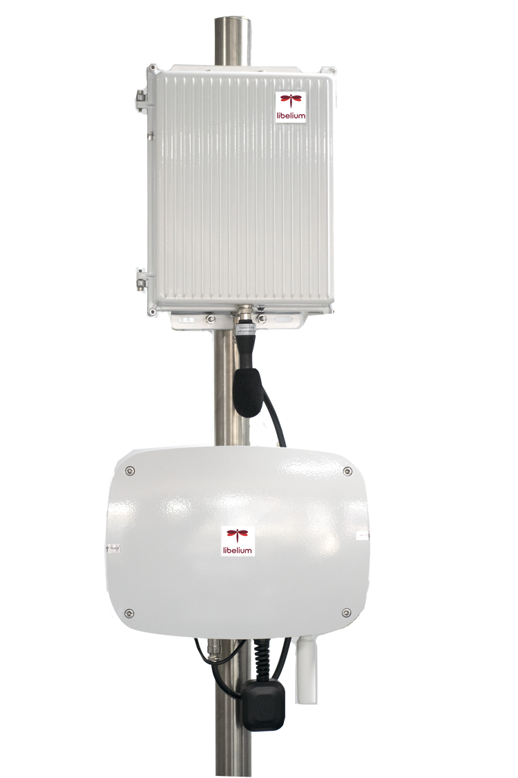
Smart Spot Air and environmental sources capture pollutant concentrations and environmental variables from strategically deployed monitoring points.
Transmit and combine field measurements, existing monitoring networks and relevant contextual information in one data environment.
Visualise current conditions, analyse spatial patterns and compare alternative mobility and environmental scenarios.
Use environmental intelligence to support decisions such as Low Emission Zones and mobility changes, then compare expected outcomes with real-world results.
Smart Spot Air and environmental sources capture pollutant concentrations and environmental variables from strategically deployed monitoring points.
Transmit and combine field measurements, existing monitoring networks and relevant contextual information in one data environment.
Visualise current conditions, analyse spatial patterns and compare alternative mobility and environmental scenarios.
Use environmental intelligence to support decisions such as Low Emission Zones and mobility changes, then compare expected outcomes with real-world results.
Smart Spot Air provides the physical sensing layer of the solution, combining multiple environmental variables within a single monitoring point.
Monitor relevant gaseous pollutants according to project configuration.
Add temperature, humidity and pressure as environmental context.
Include acoustic monitoring where required by the project architecture.
No results match your search.
Monitor particulate matter such as PM1, PM2.5 and PM10 when configured.
Integrate relevant meteorological information according to project requirements.
Adapt communications to the deployment environment.
No results match your search.
Environmental sensing only creates value when measurements can be trusted. Libelium combines field deployment knowledge with calibration and environmental data-quality expertise to create a stronger foundation for analysis.
Libelium Lab is a Calibration Laboratory accredited by ENAC, with accreditation No 285/LC10.250 according to UNE-EN ISO/IEC 17025.
Support better measurement consistency through environmental calibration knowledge and reference processes.
Identify unreliable or inconsistent environmental information before it reaches the analytical layer.
Connect real deployment conditions with specialist environmental measurement expertise.
Bring environmental observations, spatial context and scenario modelling into one digital environment to understand current conditions, evaluate alternatives and compare the expected impact of urban interventions.
Current Conditions
Follow the operational view of the city as the primary state, with the multi-domain overview and the pollutant selector as supporting views.
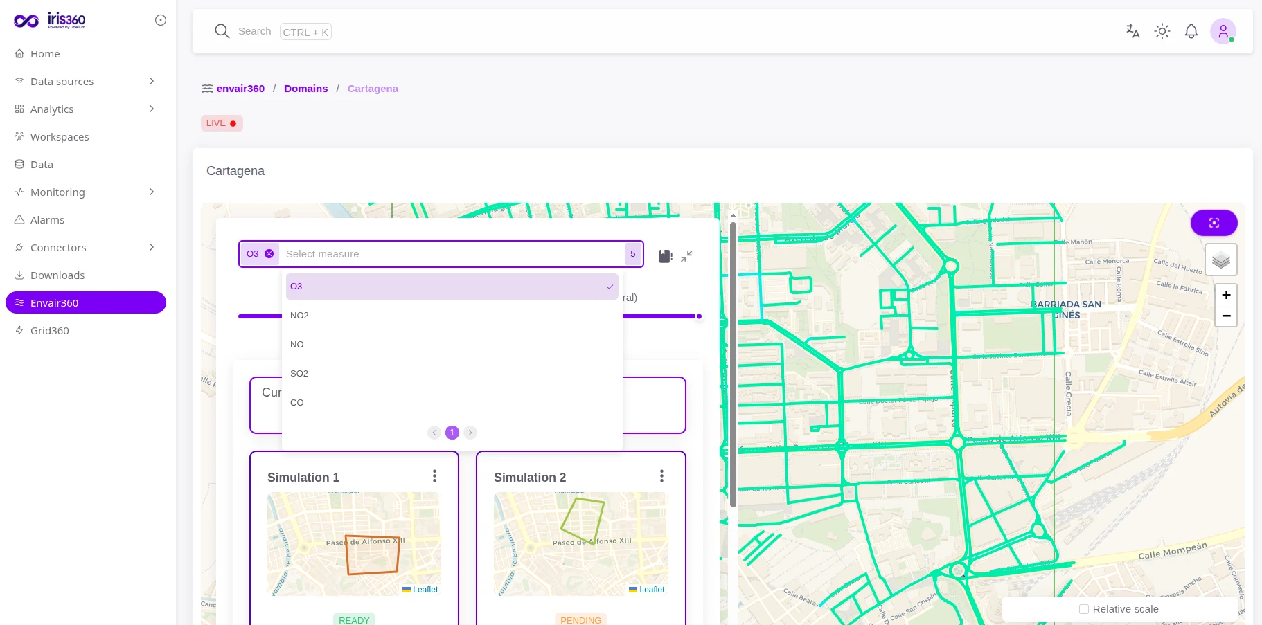
Current operational view of Cartagena.

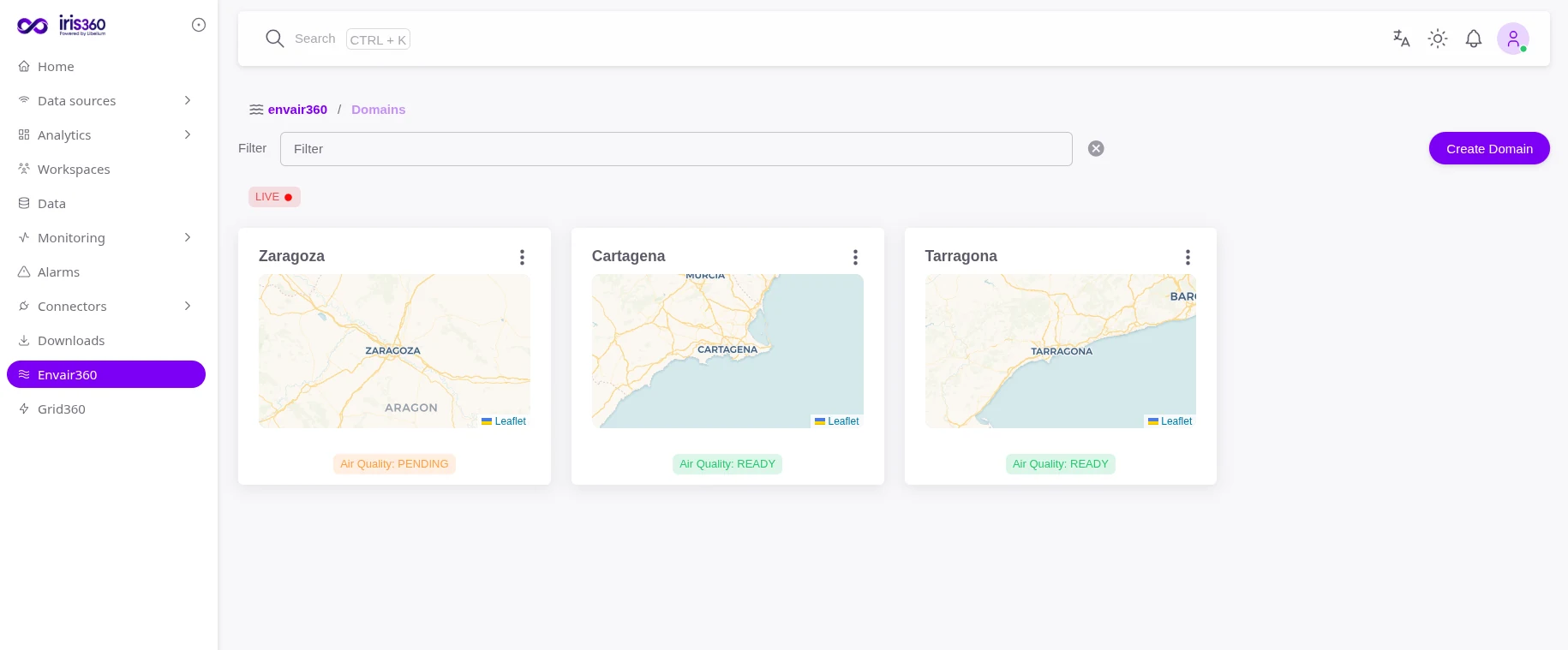
Overview across several domains.
Pollutant selector.
Spatial Analysis
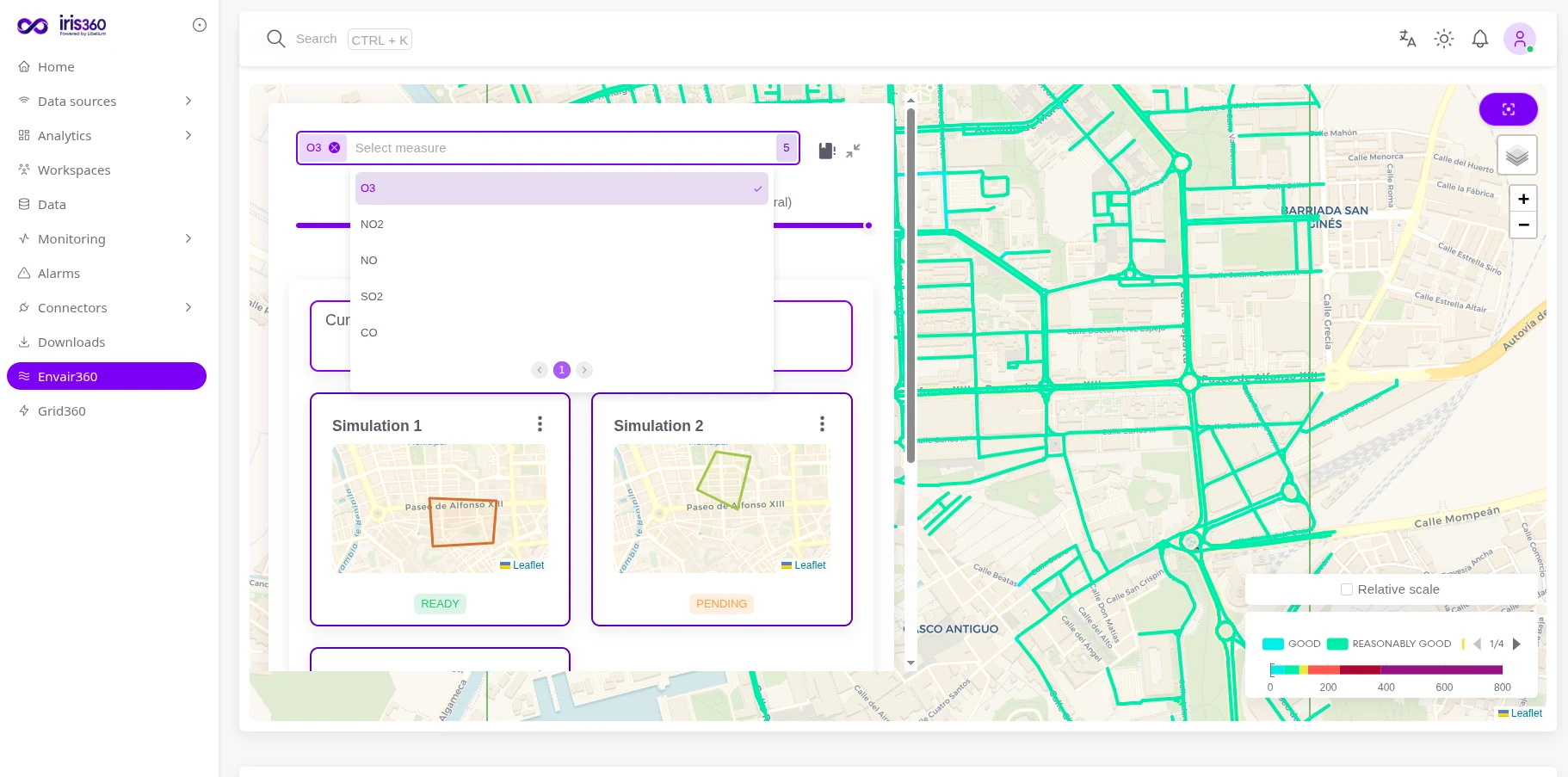
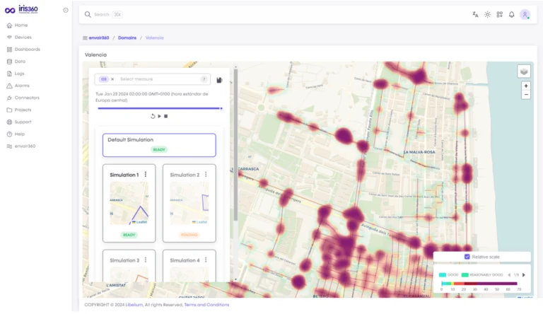
Use the spatial heatmap view to identify concentrations and spatial patterns while keeping the complete map context.
Spatial heatmap of pollutant concentration.
Simulate
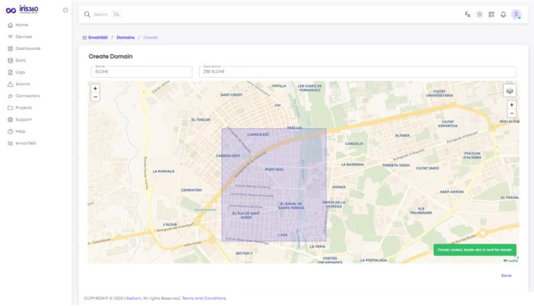
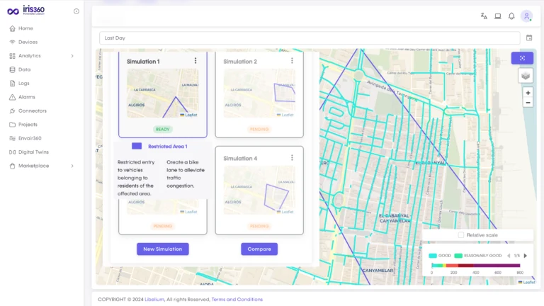
Define the geographical area of the domain first, then create the simulation scenarios.
Defining the geographical area of the domain.
List of simulation scenarios and their status.
Compare
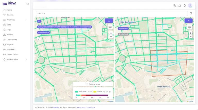
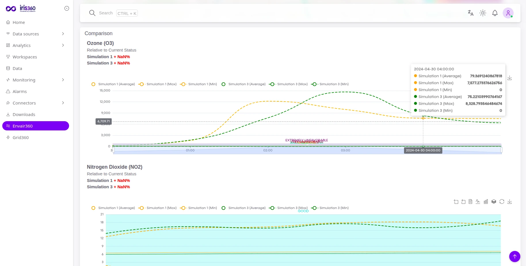
Compare the current situation and alternative scenarios on the map and analytically through pollutant evolution.
Comparison of the current situation vs. a scenario.
Analytical comparison of pollutant evolution.
combines current conditions, spatial analysis and scenario modelling to turn air-quality data into decisions.
Deploying iris360 does not require replacing existing hardware or wireless sensors. Our open FIWARE NGSI-LD models, REST and MQTT ingestion pipelines connect directly to legacy devices, giving you unified operational dashboards from day one.
Locate areas where environmental attention is most relevant.
Relate air-quality behaviour to traffic, access and urban mobility patterns.
Evaluate Low Emission Zones, restrictions and urban measures before implementation.
Understand how different scenarios may affect environmental conditions.
Focus interventions where evidence indicates they may have greater relevance.
Compare expected outcomes with observations after implementation.
No results match your search.
Evaluate environmental conditions and mobility-related interventions.
Understand environmental impact around complex mobility and logistics activity.
Analyse environmental behaviour around major routes and nearby urban areas.
Compare conditions before and after infrastructure or mobility changes.
Understand environmental conditions where citizen exposure and quality of life matter.
No results match your search.
Environmental, mobility and urban information were combined to understand existing conditions, evaluate intervention scenarios and support the design of Cartagena’s Low Emission Zone.
Connect sensing infrastructure with environmental intelligence in one solution architecture.
Apply specialist environmental knowledge beyond generic IoT connectivity.
Strengthen the reliability of the information feeding environmental decisions.
Combine Libelium monitoring with relevant external environmental and contextual sources.
Move from observing current conditions to evaluating potential future scenarios.
No results match your search.
Discover how La Unión (Murcia) uses Libelium’s IoT technology and iris360 to lead the way in...
Summer festivals = magic... until you hit endless lines and crowd chaos. Why do we still...
The transition towards a cleaner and more environmentally friendly energy generation model has become unstoppable. Globally,...
Work with Libelium to combine environmental sensing, calibration expertise and iris360 into a solution designed around the decisions your territory needs to make.