

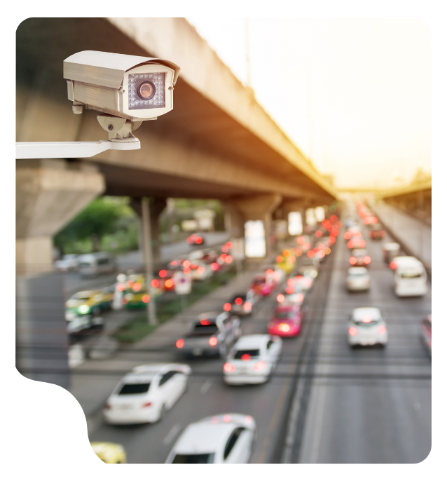
Until recently, measuring the environmental footprint of vehicles on the road was an exercise in estimates based on averages. Public administrations faced “data blindness”: they knew how many cars passed by, but not their real impact.
The challenge posed by current mobility is immense: How to identify makes, models, registration years, and environmental labels of thousands of moving vehicles without relying exclusively on a static license plate database? Libelium’s answer arrives in the form of innovative technology, of course: transforming video surveillance camera infrastructure into intelligence with computer vision to convert traffic into structured knowledge.
What is computer vision and why is it key to intelligent mobility?
Computer vision is the technology that best responds to the needs posed by constantly evolving urban mobility. That is why at Libelium, we could not miss the opportunity to integrate it into our data management and intelligence platform, iris360. This innovation promises to transform mobility management in cities.
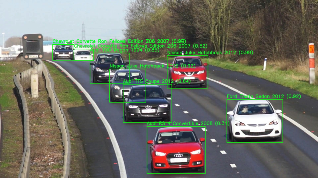
The challenge is to distinguish what type of vehicle the camera is seeing and assign an environmental footprint index based on several parameters.
The system distinguishes and analyzes mobility without the need to read license plates, which allows:
- Distinguishing the type of traffic (car, motorcycle, van, etc.).
- Determining vehicle occupancy (car sharing, single driver, etc.).
- Estimating the level of pollutants emitted.
- Detecting incidents (accidents, double-parking, etc.).
- Identifying the car’s environmental sticker (ECO, A, B, C…).
Once the camera data is processed in iris360, we design an artificial intelligence model to analyze the environmental impact of traffic in real time. But not only that, this information feeds the digital twin to simulate future scenarios and, only then, make decisions.
Libelium’s ability to transform these images into data is key. Only in this way can aspects such as the type of vehicle, occupancy, incidents like accidents or double-parking, and even the type of sticker the car has, be analyzed through different algorithms, all without the need to read license plates.
Additionally, this innovation allows for enriching Libelium’s envair360 solution, with which any city can design and manage its low-emission zone (LEZ) intelligently.
Step 1 of computer vision: teaching already installed cameras to see
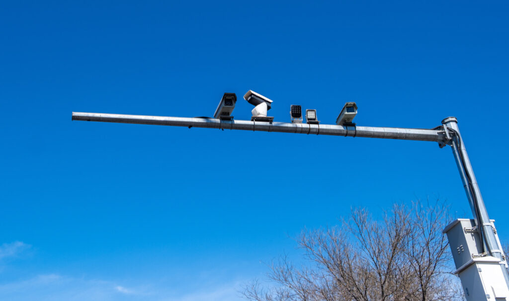
In cities, we live surrounded by video surveillance cameras. It is estimated that in Spain there are more than 900,000 video surveillance cameras in total. This is equivalent to approximately one camera for every 52 inhabitants. So… why install new ones if we can teach these ones to see different things?
Urban management faces complex challenges. Population growth and traffic congestion are some of these concerns. Computer vision offers innovative solutions to these problems.
One of these things we can teach them to see is the type of vehicle it is looking at. This is of great help to public managers because the 2030 Agenda establishes that cities with more than 50,000 inhabitants:
- Must reduce emissions from their vehicle fleet by 45% by 2030.
- Must eliminate CO2 emissions from vehicles by 2050.
However, the lack of a technological tool that allows for effectively measuring the environmental footprint of vehicles is a challenge that slows down the achievement of this goal.
Furthermore, one of the main challenges for cities is the integration of new solutions with already existing infrastructures, and often, cities have legacy systems that are difficult to update.
Despite these challenges, the opportunities are innumerable (and surely you are already thinking of other use cases). Computer vision can transform mobility management in urban areas. Some applications include:
- Traffic optimization: Analysis of traffic patterns to improve flow.
- Environmental monitoring: Detection of pollution levels in real time.
- Public transport management: Efficient coordination of vehicles and routes.
Additionally, data management is crucial. Computer vision generates large volumes of information. Effective processing and analysis of this data require advanced technologies.
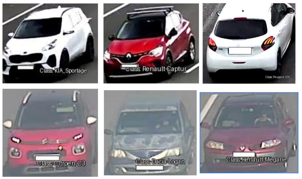
But how do you teach a camera to see? To help a video surveillance camera become a computer vision tool, it needs to know what is happening in front of its lens. This is done through data labeling: the camera captures the image of a car and sends it to iris360, where a database has been loaded that allows it to know if it is a car or a van, what model it is, or even what label it carries.
Step 2: Algorithmic modeling of the vehicle fleet environmental footprint in iris360
Libelium has developed iris360 with the goal of expanding its functionalities and capabilities to address any use case related to environmental management in industry and cities.
This design facilitates the implementation of any innovation in iris360. Furthermore, it happens like with languages: as iris360 integrates more functionalities, incorporating new ones becomes simpler.
Images are a valuable input, but they must be transformed into data.
The integration of intelligent vision into the iris360 platform is materialized through a hybrid ecosystem that combines cutting-edge hardware and Deep Learning algorithms. Libelium deployed smart cameras and implemented a workflow based on YOLO (You Only Look Once) detection models.
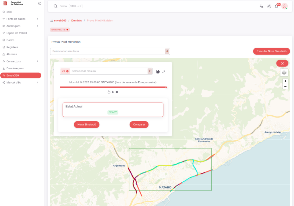
This technology allows iris360 to perform two critical tasks simultaneously:
- Multimodal detection: Identifying if what appears in the frame is a passenger car, a truck, a van, or a motorcycle, determining its exact position and speed.
- Advanced classification: Through fine-tuning techniques and a proprietary dataset of over 50,000 images, the system is capable of distinguishing between 625 vehicle classes, identifying make and model even in conditions of low visibility or adverse weather.
What makes this solution unique is its ability to anonymize data at the source, guaranteeing citizen privacy while extracting valuable metadata for urban management.
Step 3: The design of the urban mobility digital twin
The true magic happens when computer vision meets the analysis engine of iris360. The data extracted by the cameras feeds a system of digital twins (based on algorithmic models).
This advancement allows mobility managers not only to see the present but to simulate future scenarios (“What-if”):
- How much would NO2 emissions be reduced if we lower the speed limit by 10 km/h?
- What is the real acoustic impact of the last-mile fleet in a specific neighborhood?
iris360 turns frames into pollution heat maps and sound emissions, allowing public policies based on scientific evidence, not statistical averages.
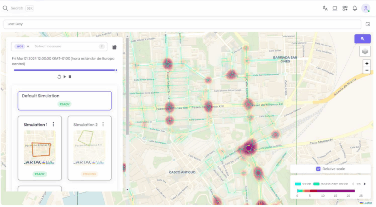
This digital twin allows, for example:
- Detection of critical sections: Accurately identifying which streets, intersections, or time slots are experiencing the highest levels of congestion or, more crucially, are correlated with peaks in atmospheric or acoustic pollution.
- Predictive analysis: Simulating the impact of changes in infrastructure (such as closing a lane, changing the direction of a road, or implementing a low-emission zone) before carrying them out in the real world.
- Dynamic optimization: Adjusting traffic lights, public transport routes, or delivery strategies in real time to alleviate traffic pressure and improve air quality.
The power of this approach is exponentially multiplied with the integration of other data sources. The mobility digital twin does not operate in isolation; it feeds on and connects with:
- Environmental sensors: Real-time data on nitrogen oxides (NOx), particulate matter (PM), and ozone.
- Noise sensors: Dynamic acoustic mapping that allows identifying noise pollution generated by traffic.
- Open Data: Meteorological information, scheduled events, sociodemographic data, and land use.
- Other digital twins: For example, integration with the sewer network digital twin could predict the impact of heavy rains on traffic.
For technology experts, the architecture of this solution is a testament to scalability. Libelium designed iris360 to process both metadata at the edge (smart cameras sending lightweight text) and complete video streams in the cloud for legacy infrastructures.
- AI models for character recognition on license plates.
- Semi-annual data enrichment with DGT microdata to cross-reference environmental categories in milliseconds.
- Interoperability based on FIWARE standards, ensuring that iris360 is a “live” platform, capable of integrating with any existing IoT ecosystem.
Use cases of computer vision in urban mobility
This comprehensive vision turns computer vision from being a counting tool into the catalyst for intelligent, proactive, and sustainable urban management, transforming the city into a living, adaptable, and optimized organism.
The use case shown in this article is for calculating the environmental footprint section by section of a highway, but we can think of other use cases of computer vision applied to mobility:
Road safety:
- Incident and accident detection: Automatic and immediate identification of collisions, stopped vehicles, objects on the road, or risky situations (for example, smoke, pedestrians, or animals on the road).
- Monitoring of dangerous driving behaviors:
- Detection of wrong-way driving.
- Identification of vehicles driving on the shoulder improperly.
- Detection of insufficient safety distance between vehicles.
- Analysis of speed and harsh braking.
- Detection of vehicles without seat belts or using mobile phones: Although legislation varies, computer vision can alert about these infractions.
- Fog or adverse weather condition alert: Visual assessment of visibility to activate corresponding warning signs.
Traffic management and efficiency:
- Vehicle counting and classification: Accurate count by type (passenger cars, trucks, buses, motorcycles) for traffic studies, planning, and tolls.
- Measurement of traffic density and fluidity: Real-time analysis of lane occupancy and average speed to optimize traffic lights or reversible lanes at entrances/exits.
- Congestion and queue formation detection: Early identification of traffic jams to inform drivers and divert traffic if necessary.
- Specific lane management (HOV, trucks, tolls): Monitoring the correct use of high-occupancy or restricted lanes.
- Origin-destination (OD) analysis: Anonymous tracking of license plates or vehicles to understand movement patterns and travel times.
Maintenance and operations:
- Infrastructure inspection: Detection of road deterioration, damaged traffic signs, or missing road markings.
- Construction zone monitoring: Tracking activity in construction areas to ensure worker safety and optimize detours.
- Detection of tires or fallen vehicle parts: Quick identification of debris or remnants that pose a danger.
Regulatory compliance (LPR – License Plate Recognition):
- Access control and electronic tolling: Vehicle detection for automatic billing or permit verification.
- Search for stolen or wanted vehicles: Real-time comparison of license plates with police databases.
Artificial intelligence and image analysis, the future of sustainable mobility
The city never sleeps, but now, finally, it understands. With the integration of Computer Vision into iris360, we have stopped ‘recording’ to start ‘interpreting’. It is not just pixels; it is the ability to distinguish between an electric scooter zigzagging and a pedestrian with reduced mobility in milliseconds. We are equipping cities with a digital nervous system that predicts traffic jams before the first driver touches the brake.
Inefficient traffic is responsible for up to 25% of CO2 emissions in urban environments. Computer Vision can reduce idling times (stopped cars) by 15-20% through real-time traffic adjustments.
Towards more efficient and human urban mobility
While you blink, iris360 has already classified 50 vehicles, detected an infraction, and adjusted the traffic light phase.
Technological advancement is revolutionizing mobility management in our cities. The integration of computer vision and artificial intelligence offers new opportunities for more efficient urban planning. These technologies promise to create environments that prioritize both efficiency and human well-being.
The future of smart cities is intrinsically linked to these types of developments. By focusing technology on sustainable and human-centric solutions, we can reimagine mobility. This not only optimizes urban systems but also improves the quality of life for its inhabitants. Urban mobility is on the threshold of a transformation that will make it more efficient and more aligned with our future needs.
Behind the Change.
Beyond the Challenge.