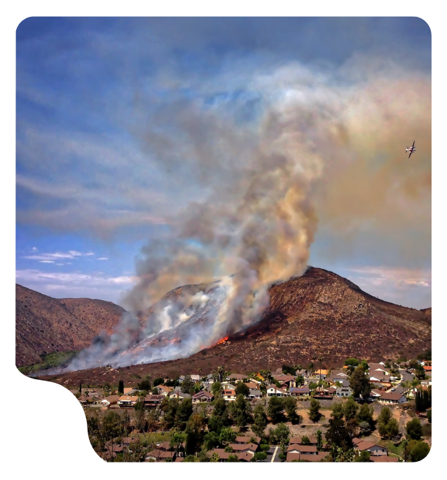
Wildfires, floods, landslides, heatwaves and other extreme weather events will continue to test the response capacity of cities, regions and public authorities.
The question is how much we can do before a risk turns into an emergency.
For years, much of the conversation has focused on response: protocols, coordination, intervention resources and operational capacity. All of this remains essential. But today we can also work at an earlier stage: improving our understanding of the territory, monitoring how certain variables evolve, identifying vulnerabilities and interpreting signals that can help us prepare for different scenarios.
To do that, we need data. More importantly, we need to understand what that data means in context.
Knowing that 40 litres of rain per square metre have fallen, that the level of a river is rising or that relative humidity has dropped rapidly gives us individual observations. Relating those observations to where they occur, how they evolve over time, available historical records and the infrastructure or population exposed is what starts turning them into useful information for decision-making.
This is where technology can extend our ability to anticipate risk.
Climate emergency management starts before the alert
A flood does not begin when water cuts off a road. A wildfire does not begin when a community has to be evacuated.
From a risk management perspective, the work starts much earlier.
It begins with accumulated knowledge about a territory: its topography, land use, river basins, forest areas, critical infrastructure, exposed population, previous events and areas of particular vulnerability.
And it continues by observing how the conditions that influence that risk are changing.
Prevention can now draw on a much wider combination of information, including weather stations, sensors deployed in the field, hydrological systems, imagery, GIS data, Earth observation, models and information provided by different public authorities.
None of these sources necessarily explains what is going to happen on its own.
Their value increases when they can be connected.
What can we measure to understand how risk is evolving?
Talking about “data” without specifying what we actually mean can make the digitalisation of emergency management sound abstract. It is not.
Monitoring technologies allow us to continuously observe physical and environmental parameters that help describe what is happening across a territory.
Not every variable is relevant to every type of emergency, nor should they be interpreted independently. Their usefulness depends on the problem we are trying to understand.
Depending on the type of risk and deployment conditions, relevant variables may include:
- Water level
- Accumulated rainfall
- Temperature
- Relative humidity
- Atmospheric pressure
- Wind speed and direction
- Soil moisture and temperature
- Soil water content
- Solar radiation
- Leaf wetness
- Certain variables related to air quality or gas concentrations
Monitoring water and the conditions that influence its evolution
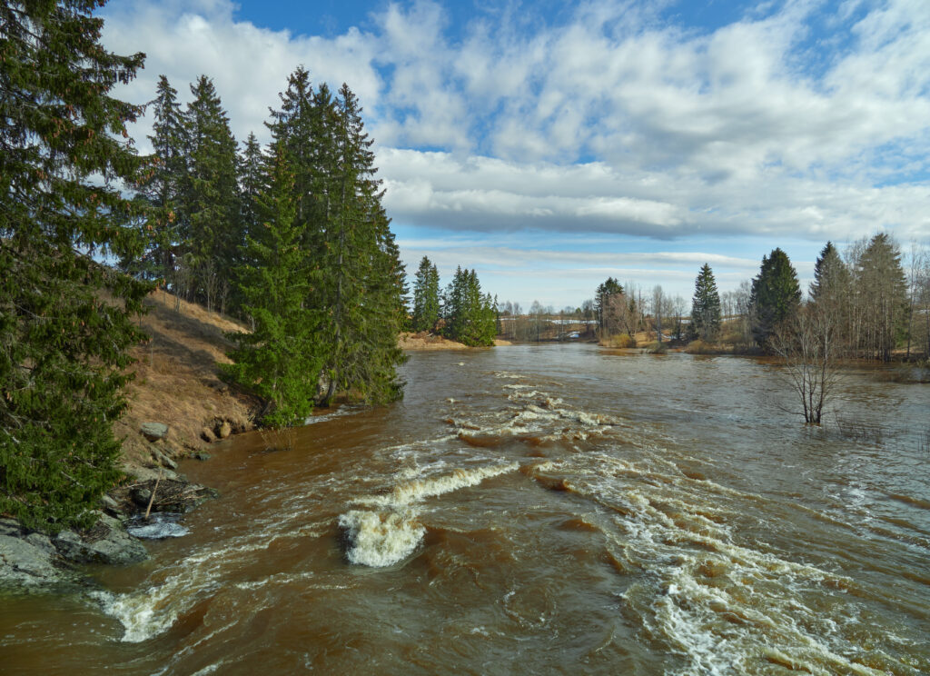
In flood risk management, for example, knowing the level of a river or ravine provides a direct signal, but it becomes much more useful when it can be analysed alongside rainfall, its evolution over time and current weather conditions.
Libelium has already worked in scenarios of this kind.
In an early flood detection and warning system deployed in Argentina, monitoring combined river level data with meteorological variables such as temperature, relative humidity, atmospheric pressure, rainfall, and wind speed and direction.
The purpose of this kind of infrastructure is not to “predict a flood” from a single sensor.
It is to continuously observe variables that can help identify relevant changes and provide more information about how the situation is evolving.
Understanding environmental conditions
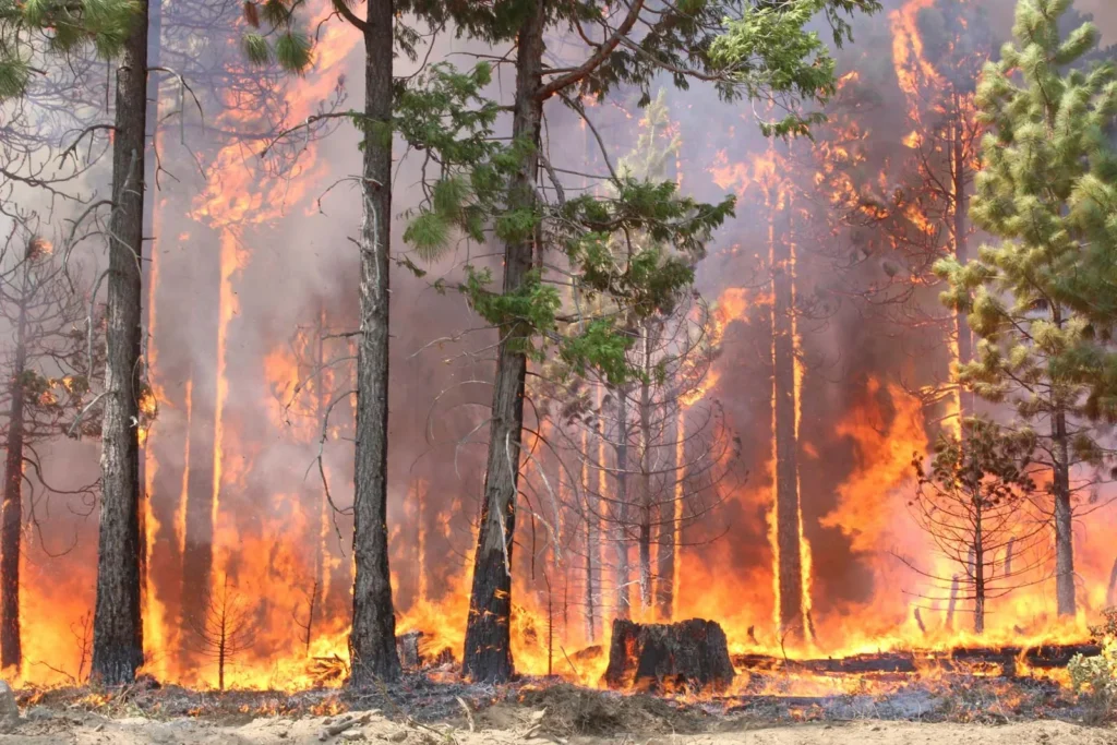
For other risks, such as wildfires or prolonged periods of heat and dryness, meteorological and environmental parameters become particularly relevant.
Temperature, relative humidity, wind, accumulated rainfall, solar radiation and certain soil conditions help describe an environment that may be experiencing greater or lower levels of stress.
Here too, it is important to avoid oversimplification.
A high temperature does not in itself mean a wildfire will occur. Neither does a particular humidity value.
But the combined evolution of several variables can improve our understanding of conditions across the territory and complement risk models, forest information, historical records and other specialist sources.
Monitoring the environment to recognise change
This logic of continuous observation is not exclusive to emergencies.
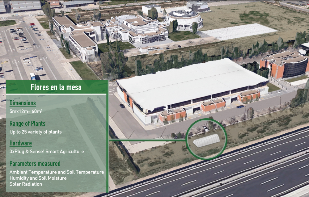
Libelium has been using environmental sensors for years to understand how changes in conditions can indicate the need for action.
In projects involving greenhouse condition monitoring or weather monitoring to prevent pests in olive groves, environmental variables are used to follow how conditions evolve and support better-informed action.
The problem is different, but the technological logic is transferable: continuously observe, detect relevant changes and use the evolution of the data to better understand what is happening.
Measurement is only the beginning: data needs context
A sensor network can generate thousands of measurements. That does not mean an emergency manager should have to review thousands of individual values. In fact, that is where another part of the challenge begins.
A temperature measurement of 38°C has limited meaning unless we know where it was recorded, how long it has remained at that level, how it compares with previous hours and what other conditions are present in the same location.
The same applies to water level.
An isolated value may tell us very little. A time series showing a sustained increase tells a different story. If that information can also be related to rainfall, weather forecasts, topography, vulnerabilities and historical records, the data gains context.
That is why having data is not enough.
Monitoring capabilities need to be supported by tools that can organise, visualise and connect information.
From sensors to a data platform
The journey of the data does not end when a sensor takes a measurement.
Information can be transmitted from devices deployed across the territory to a platform where it can be stored, represented and analysed alongside other sources.
This is where a solution such as iris360 begins to make sense.
Not as the final destination of the data, but as the digital environment where different sources of information can begin to form part of a common view.
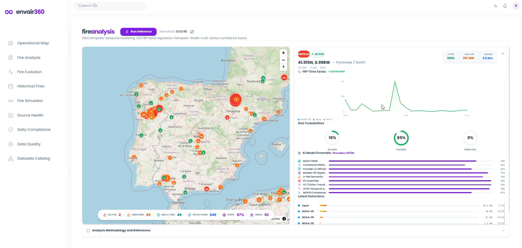
Instead of reviewing each device individually, data can be displayed through dashboards, time series and geographic representations. This makes it possible not only to understand the current situation, but also to compare periods, detect trends and identify where change is taking place.
iris360 is designed to operate precisely at this layer of data integration, visualisation and contextualisation. The platform can consolidate information from devices and other sources and allow users to work with that information within a territorial context. Its interface includes capabilities such as data visualisation, analytics, maps and alarm management.
The important change is not technological. It is operational.
Instead of receiving: “water level: X”
we can begin to understand: “the water level has been rising for a given period at this specific location”.
That second piece of information is much more useful.
Configuring alarms to identify situations that require attention
One advantage of continuous monitoring is that a person does not have to manually detect every change.
Thresholds and alarm conditions can be established for selected parameters.
For example, it may be useful to receive an alert when:
- the level of a river exceeds a defined value;
- a measurement increases or decreases beyond a predefined level;
- rainfall reaches a threshold considered relevant;
- an environmental variable moves outside a specified range;
- certain conditions indicate that a situation should be reviewed.
This is where the difference between simply having data and having an operational monitoring system becomes particularly clear.
Data is no longer something we only consult when we want to know what is happening.
The system can indicate when a previously defined condition requires attention.
In a platform such as iris360, data visualisation and alarm configuration make it possible to work with this logic: follow the evolution of variables and create notifications for specific scenarios involving increases, decreases or threshold breaches.
This does not turn an alarm into a prediction. That distinction matters.
An alarm indicates that a condition we have chosen to monitor has occurred. From that point, emergency management expertise, additional datasets, specialised models, weather forecasts or operational protocols can come into play.
Technology helps reduce the time between “something is changing” and “someone needs to know about it”. In emergency management, that time can be relevant or even critical.
Integrating information before trying to predict
Field monitoring is only one of the available sources of information.
Public authorities also work with meteorological data, hydrology, cartography, forest information, Earth observation, imagery, historical records, models and information provided by different organisations.
The challenge appears when every source lives in a different system.
One organisation has one dataset; another department has another. Formats and update frequencies may differ, and the information may not always reach the person making a decision in a unified way.
That is why interoperability matters so much. A data platform can incorporate and contextualise sources that do not necessarily come from Libelium sensors.
This point is particularly important for understanding how the company’s proposition has evolved. The objective is not to deploy sensors where useful information already exists. It is to connect information collected from the territory with other sources and create a more complete picture of the situation. The sensor covers what needs to be measured. The platform gives that measurement context. Other sources complete the picture.
From observing what is happening to analysing what could happen next
Once information can be integrated and contextualised, certain situations can be analysed using models, simulations, artificial intelligence or digital twins.
A hydrological model can study possible changes in river behaviour. A propagation model can explore different wildfire scenarios.
A digital twin can represent a territory or infrastructure and make it possible to analyse scenarios that would be impossible to test in the real environment.
This introduces an important shift in risk management.
Monitoring mainly answers: what is happening?
Scenario analysis adds another question: what could happen if these conditions evolve in a particular way?
It will not always be possible to answer that question with sufficient accuracy. Different hazards also have different levels of predictability.
But even when exact prediction is not possible, exploring scenarios can help identify vulnerabilities, prepare resources and assess different alternatives.
Anticipation does not mean guessing
Climate emergency management necessarily involves uncertainty.
Not every risk can be anticipated with the same level of confidence. Models have limitations. Information may be missing, and real situations may evolve differently from the scenarios considered.
Technology can help us manage that uncertainty more effectively, but it cannot eliminate it. This is why data needs to coexist with scientific knowledge, specialist models, operational experience and local knowledge of the territory.
This limitation also matters when designing alarms.
Setting thresholds that are too sensitive can produce a stream of alerts with little operational value. Setting them too late can reduce the available time to respond.
The real value comes when monitoring and knowledge of the risk are designed together.
The objective is not to generate more alerts. It is to generate alerts that make sense to the people who have to make decisions.
How technology and AI add value
Artificial intelligence can provide value when large volumes of data need to be processed, patterns recognised or relationships analysed that would be difficult to identify manually. But it should not be the starting point of the conversation either. First, we need reliable data, a good representation of the territory and models suited to the problem we are trying to solve. Built on that foundation, AI can help detect anomalies, classify situations, analyse trends or make complex information easier to interpret.
Its most useful contribution to emergency management may not be the promise of infallible prediction. It may be something much more practical: helping decision-makers understand a complex situation sooner.
Information does not have the same value at every stage of an event.
This is the stage for identifying vulnerabilities, deciding which variables need to be measured, analysing historical data, integrating sources and defining thresholds or scenarios that require attention.
Continuous monitoring also makes it possible to establish a baseline for the normal behaviour of a territory.
Without understanding what is normal, it is much harder to recognise what is not.
Once an event is underway, time has a different value.
Updated measurements make it possible to follow the evolution of critical variables. A data platform can help visualise this information across the territory, while alarms can identify changes that need attention.
The person responsible does not need to see every individual data point.
They need to understand what is changing, where and how quickly.
Once the emergency has passed, the data remains useful.
Recorded time series can help reconstruct what happened, compare reality with expected scenarios, assess which alarms proved relevant and identify information that would have been useful to have earlier.
That learning can then be used to review thresholds, improve models and prepare more effectively for the next event.
Resilience is also built in this way.
From measuring the territory to making better decisions
The role of technology in climate emergencies can be understood as a chain:

Sensors are only the beginning. Their role is to convert specific physical conditions in the territory into data that can be used.
Platforms such as iris360 can bring those measurements into an environment where they can be visualised, connected with other information, positioned geographically and associated with alarms or scenarios that help identify relevant changes.
Models, simulations, artificial intelligence or digital twins can then be incorporated where the problem requires them. This is also where the evolution of Libelium makes sense.
Not simply as a manufacturer of the technology that captures a measurement, but as a company able to work across the journey between what is happening in the territory and the decision an organisation needs to make.
Technology will not prevent every wildfire, flood or extreme weather event.
But it can help us recognise sooner that something is changing, understand what that change means and approach a risk situation with more information and a greater ability to act.
And in emergency management, being better prepared can make an important difference.
Frequently asked questions about technology and climate emergencies
It depends on the type of hazard. Relevant variables may include water level, rainfall, temperature, relative humidity, atmospheric pressure, wind speed and direction, soil moisture and temperature, or solar radiation. The choice of parameters should always respond to the specific risk being studied.
No. A sensor measures a specific variable. Anticipation comes from combining how that variable evolves with other measurements, territorial information, historical data, forecasts and, where appropriate, specialist models.
Alarms make it possible to notify users when a variable reaches a value or follows a pattern that has previously been defined as relevant. An alarm does not necessarily mean that an emergency will occur; it indicates that a condition requiring attention has been detected.
It can centralise and visualise information from different sources, place that information within a territorial context, analyse how it evolves and configure alarms for selected parameters. This contextual layer helps move from consulting isolated data points to understanding a broader situation.
Because climate risk can rarely be understood from a single variable. Data captured in the field becomes more valuable when it can be combined with meteorology, GIS, hydrology, historical records, models and other available sources.
Monitoring helps us understand what is happening now. Anticipation uses that information, together with context, historical data and models, to identify possible future developments and prepare decisions before a situation reaches a critical point.
Behind the Change.
Beyond the Challenge.